With hurricane season upon us, it is predictable that almost all storms which threaten the U.S. will be attributed to global warming. The next two hurricane seasons, given the political climate, will likely mean some cat 5 bloviating no matter what the case. As I like to do, I have decided to explain why something may happen, beforehand, and why it’s perfectly natural.
I took 3 areas and some selected sites to review some notable storms, what happened, and why something worse could happen.
I strongly advise you to arm yourself with hurricane history to resist the onslaught of hysteria in store.
Here is the northeast map with examples for southern New England, around NYC, then south down the coast:
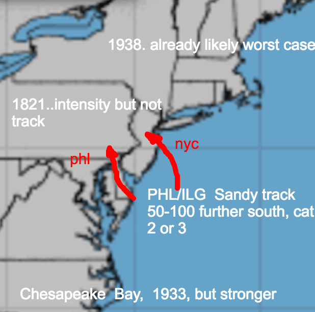
The 1938 hurricane is one of the greatest extremes that far north I can imagine. Its intensity approaches the high limit for a hurricane in that area. If one clocked in a bit stronger, perhaps a cat 4, that would be within natural variation given we have seen something like this before.
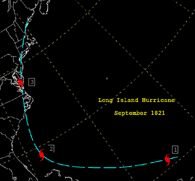
The track:

Not mentioned here, but potentially even worse, would be the Carol/Edna tandem of 1954. Two majors in 11 days, yet Edna veered over Cape Cod and spared areas further west that were still devastated from Carol. Two major hurricanes in 11 days on the New England coast is far worse than anything we have seen since, and 1954 was also the year of Hazel, meaning three majors in one season on the east coast.
1821 had the intensity, but not the prime track for NYC. A storm of that intensity hooking NW with a landfall south of the city would be the worst case ( red in map above).
Map:
I drew a second red track needed for the worst case for Philadelphia, Wilmington , and the south Jersey shore. The track would be, south of Sandy’s track. There is no reason why a storm cannot be a cat 3 or 4 doing that, ( as strong as 1821 but again coming from the SE as its caught in a trough to its southwest If you can get an 1821 that strong with a track over or near land then a storm coming from the ocean can be also).
Sandy track:
.png)
For Chesapeake bay including tidewater, and up to DC/BWI, the 1933 track was nearly worst case. A stronger version of that can certainly occur and is well within the realm of nature.

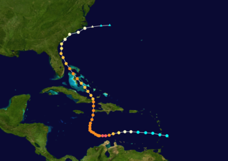
Donna was a 4 in FLA, a 3 in the Carolinas, then a 2 in New England. Unlike Irma and Charley, Donna walloped a much larger area.
Donna track:

Lets move to the southeast:
 \
\
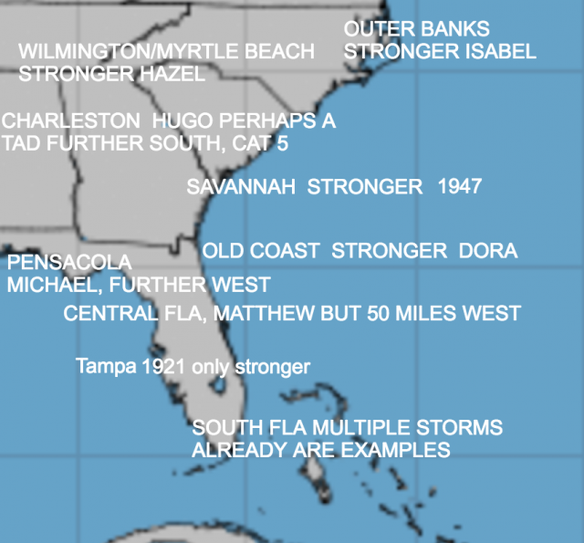
In the southeast, Isabel in 2003, stronger would be the worst case for the Outer Banks:

Myrtle Beach to Wilmington saw the Cat 4 Hazel in 1954:

Hazel came in October. In September, a similar track could easily have reached cat 5. Again the storm we have seen, plus intensities we have seen, argue that any given storm could have a higher intensity,
Hugo, a bit further southwest, with its hit near Charleston, and a bit stronger, would be the low country’s worst case, going in SW of Charleston:


The absurdity of believing the time we are in now to be the worst, does not stand up when put in the historical perspective.
The 1921 Tampa hurricane, the only major hit recorded there ( it’s very hard to hit the Florida coast between Tampa and Apalachicola), is another track where had it ramped up a bit in intensity coming to the coast like Michael, could have been a worst case:

Which brings us to New Orleans.
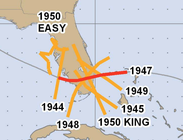
Katrina was not a worst case. That would be a more intense version of the 1947 hurricane track which was Ft Lauderdale’s worst

Quite frankly, New Orleans is as bad as it gets, when I add in other factors.
Further west lets take a look at the map:
.png)
People need to understand how bad it can get. The town of Indianola Texas was the number one port on the gulf coast until two hurricanes devastated it in very short periods of time. The first one hit in 1875 and they tried to rebuild then the second hit in 1886. Then they gave up.
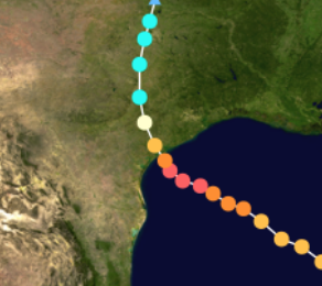
Further south, Celia in 1970 went in just north of Corpus Christi and had deepened from a Cat 1 to a 945 MB cat 3 in the last 18 hours, Highest wind gusts reached 161 mph at Aransas Pass:
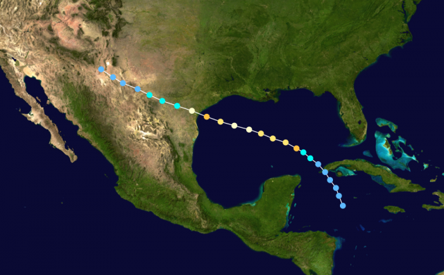
For the Lower Rio Grande Valley, the prime example of how bad it can get is Beulah in 1967, but she weakened to a cat 3. The same track maintaining intensity would have been even more devastating:
